Description
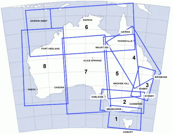
The En-Route Chart Low (ERC (L)) is drawn to various scales to accommodate significant air traffic route areas and shows controlled airspace, prohibited, restricted and danger areas, air routes, ATS and radio-navigation services.
Aeronautical information within Terminal areas may not be complete. Pilots should refer to a TAC or VTC for further detail.
This chart is amended every 6 months.
ER-ROUTE CHARTS LOW AUSTRALIA
ERC LOW 1/2 - MELBOURNE/CANBERRA/ADELAIDE
ERC LOW 3/4 - SYDNEY/BRISBANE/CAIRNS/TOWNSVILLE
ERC LOW 5/6 - BROKEN HILL/DARWIN/CAIRNS/TOWNSVILLE
ERC LOW 7/8 - ADELAIDE/ALICE SPRINGS/MOUNT ISA/PERTH/PORT HEADLAND


