Description
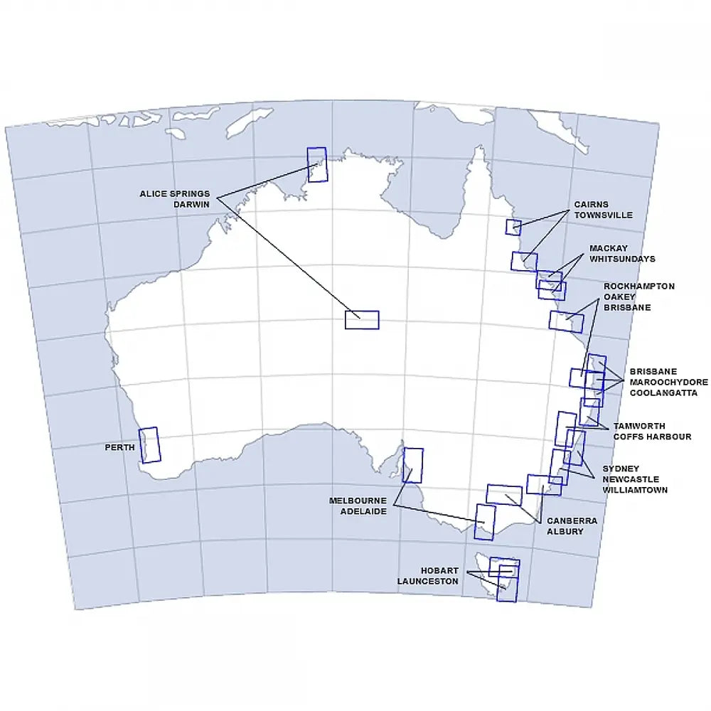
Visual Terminal Charts (VTC) provide both aeronautical and topographical information at a scale of 1: 250 000 for VFR operations in the vicinity of major aerodromes. In some cases, these charts show the details of tracks to be flown and significant landmarks which are used by pilots of VFR aircraft to avoid inadvertent penetration of controlled airspace.
Note: In addition to full topographical information, the VTCs also show the following details:
- Prohibited, restricted and danger areas within terminal areas
- Control zones and associated control areas lanes of entry ATC check pointsVFR approach points - over which pilots should fly when making VFR entry to a primary control zone.
These charts are amended every 6 months.
VISUAL TERMINAL CHARTS AUSTRALIA
VTC - MELBOURNE/ADELAIDE
VTC - MILDURA
VTC - HOBART/LAUNCESTON
VTC - CANBERRA/ALBURY
VTC - SYDNEY/NEWCASTLE
VTC - COFFS HARBOUR/TAMWORTH
VTC - BRISBANE/SUNSHINE COAST/GOLD COAST
VTC - OAKEY/BRISBANE/ROCKHAMPTON
VTC - CAIRNS/TOWNSVILLE
VTC - MACKAY/WHITSUNDAY
VTC - ALICE SPRING/AYRES ROCK/DARWIN
VTC - PERTH
VTC - BROOME/KARATHA
VTC - HORN ISLAND


